Search Results 692 items were found.
Keywords: map
-
- Item 11823
-
- Champlain map copy, Saint Croix or Bone Island, ca. 1799
- Contributed by: Maine Historical Society
- Date: circa 1613
- Media: Ink on paper
-
Buy


-
- Item 59801
-
- Freeport electric railroads map, ca. 1929
- Contributed by: Seashore Trolley Museum
- Date: circa 1929
- Location: Freeport
- Media: Ink on paper
-
Buy


-
- Item 4319
-
- Plan of Freeport, ca. 1795
- Contributed by: Maine Historical Society
- Date: circa 1795
- Location: Freeport; New Gloucester; Brunswick
- Media: Ink on paper
-
Buy


-
- Item 12570
-
- Foster's Neck, Georgetown, 1746
- Contributed by: Maine Historical Society
- Date: 1746-11-01
- Location: Georgetown
- Media: Ink on paper
-
Buy


-
- Item 4325
-
- "Brunswick in the late Province of Mayne in New England," 1719
- Contributed by: Maine Historical Society
- Date: 1718-01-28
- Location: Brunswick
- Media: Ink on paper
-
Buy


-
- Item 11989
-
- Plan of Ann (now Park) Street, Portland, ca. 1802
- Contributed by: Maine Historical Society
- Date: circa 1802
- Location: Portland
- Media: Pen, Ink and watercolor on paper, map
-
Buy


-
- Item 33847
-
- Champlain's map of Saco Bay and the Saco River, 1605
- Contributed by: McArthur Public Library
- Date: 1605
- Location: Biddeford; Saco
- Media: Photographic print
-
Buy


-
- Item 148262
-
- Map of highways, rivers, bridges, and houses of worship in Falmouth, together with public and private buildings, Portland, ca. 1804
- Contributed by: Maine Historical Society
- Date: circa 1804
- Location: Portland; Cape Elizabeth; Westbrook; Gorham; Scarborough
- Media: ink on paper
-
Buy


-
- Item 8674
-
- Map of Buck Peters locations, Fryeburg, ca. 1912
- Contributed by: Fryeburg Public Library
- Date: circa 1912
- Media: Ink on paper
-
Buy


-
- Item 11966
-
- Filling Back Cove, Portland, 1837-2003
- Contributed by: City of Portland Dept. of Public Works
- Date: 1837
- Location: Portland
- Media: Ink on paper, map
-
Buy


-
- Item 4318
-
- Androscoggin River above Lewiston, ca. 1750
- Contributed by: Maine Historical Society
- Date: circa 1750
- Location: Turner; Livermore; Wayne; Leeds
- Media: Ink on paper
-
Buy


-
- Item 62538
-
- General Plan for Western Promenade, Portland, 1905
- Contributed by: Maine Historical Society
- Date: 1905
- Location: Portland
- Media: Ink on paper
-
Buy


-
- Item 9259
-
- Early map of the Salmon Falls River in Lebanon, 1766
- Contributed by: Maine Historical Society
- Date: 1766
- Location: Lebanon
- Media: Ink on paper
-
Buy


-
- Item 4323
-
- "Scituate," Brunswick, 1738
- Contributed by: Maine Historical Society
- Date: 1738
- Location: Brunswick; Harpswell; Topsham
- Media: Ink on paper
-
Buy


-
- Item 52214
-
- Map of Pepperell Park, Saco, 1884
- Contributed by: Dyer Library/Saco Museum
- Date: 1884
- Location: Saco
- Media: Photographic print
-
Buy


-
- Item 11967
-
- Back Cove fill history, Portland, 1837-2003
- Contributed by: City of Portland Dept. of Public Works
- Date: 2003
- Location: Portland
- Media: Ink on paper, map
-
Buy


-
- Item 11961
-
- Location of wharves in Portland Harbor, 2001
- Contributed by: City of Portland Dept. of Public Works
- Date: 2001
- Location: Portland
- Media: Ink on paper, map
-
Buy


-
- Item 12200
-
- Maps of lots on the Androscoggin River, ca. 1760
- Contributed by: Maine Historical Society
- Date: circa 1760
- Location: Jay; Canton; Livermore Falls
- Media: Ink on paper
-
Buy


-
- Item 8564
-
- North shore, Lake Huron, ca. 1819
- Contributed by: Maine Historical Society
- Date: circa 1819
- Media: Ink on paper
-
Buy


-
- Item 16128
-
- Mildred Burrage's painted map of 1775 destroyed Falmouth Neck, 1925
- Contributed by: Maine Historical Society
- Date: 1775-10-18
- Location: Portland
- Media: Painted gesso
-
Buy


-
- Item 20784
-
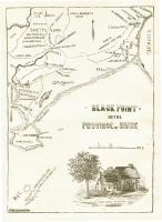
- Black Point, Scarborough, ca. 1633 - 1728
- Contributed by: Maine Historical Society
- Date: circa 1633
- Location: Scarborough
- Media: Ink on paper, map
-
Buy


-
- Item 4316
-
- Plan of J. Robinson lot, Topsham, 1761
- Contributed by: Maine Historical Society
- Date: 1761
- Location: Topsham
- Media: Ink on paper
-
Buy


-
- Item 11962
-
- Vaughan Plan, ca. 1813
- Contributed by: City of Portland Dept. of Public Works
- Date: circa 1813
- Location: Portland
- Media: Ink on paper, map
-
Buy


-
- Item 110949
-
- Boundary survey between New Brunswick and Maine, 1842
- Contributed by: Maine Historical Society
- Date: 1842
- Media: Ink on paper
-
Buy


