Search Results 355 items were found.
Keywords: manuscript
-
- Item 116493
-

- Crooked Lake and Lake Namacan, ca. 1820
- Contributed by: Maine Historical Society
- Date: circa 1820
- Media: Ink on paper
-
Buy


-
- Item 12852
-

- Kennebec River above Fort Western, ca. 1800
- Contributed by: Maine Historical Society
- Date: circa 1800
- Media: Ink on paper
-
Buy
-
- Item 12411
-

- Samuel and Hugh Wilson survey, 1767
- Contributed by: Maine Historical Society
- Date: 1767
- Media: Ink on paper
-
Buy
-
- Item 12626
-

- Mereconege Neck, Harpswell, ca. 1780
- Contributed by: Maine Historical Society
- Date: circa 1760
- Media: Ink on paper
-
Buy
-
- Item 12631
-

- Five farm lots, Bowdoinham, 1718
- Contributed by: Maine Historical Society
- Date: 1718
- Media: Ink on paper
-
Buy
-
- Item 11746
-

- Merriconeag Neck, 1749
- Contributed by: Maine Historical Society
- Date: 1749-07-04
- Media: Ink on paper
-
Buy
-
- Item 74461
-
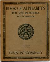
- "Book of Alphabets," 1908
- Contributed by: Maine Historical Society
- Date: 1908
- Media: Ink on paper
-
Buy
-
- Item 6849
-

- Hallowell, 1794
- Contributed by: Maine Historical Society
- Date: 1794
- Media: Ink on paper
-
Buy
-
- Item 11729
-

- Land surveyed for Hugh Wilson, Topsham, 1761
- Contributed by: Maine Historical Society
- Date: 1761-01-01
- Media: Ink on paper
-
Buy
-
- Item 11732
-

- Map of Topsham, ca. 1760
- Contributed by: Maine Historical Society
- Date: circa 1760
- Media: Ink on paper
-
Buy
-
- Item 11751
-

- North Yarmouth road, Yarmouth, ca. 1760
- Contributed by: Maine Historical Society
- Date: circa 1760
- Media: Ink on paper
-
Buy
-
- Item 11974
-

- John Merrill lot, Topsham, 1762
- Contributed by: Maine Historical Society
- Date: 1762
- Media: Ink on paper
-
Buy
-
- Item 11749
-

- "Royalston," Durham, ca. 1760
- Contributed by: Maine Historical Society
- Date: circa 1760
- Media: Ink on paper
-
Buy
-
- Item 11750
-

- Plan of road in Durham, 1770
- Contributed by: Maine Historical Society
- Date: 1770
- Media: Ink on paper
-
Buy
-
- Item 111043
-

- Northern boundary of Michigan, ca. 1820
- Contributed by: Maine Historical Society
- Date: circa 1820
- Media: Ink on paper
-
Buy
-
- Item 116506
-

- Lake Huron, Part of the Fourth Manitou, ca. 1820
- Contributed by: Maine Historical Society
- Date: circa 1820
- Media: Ink on paper
-
Buy
-
- Item 116521
-

- Detroit River, ca. 1820
- Contributed by: Maine Historical Society
- Date: circa 1820
- Media: Ink on paper
-
Buy
-
- Item 116534
-

- St. John River boundary survey, Five Islands, 1843
- Contributed by: Maine Historical Society
- Date: 1843
- Media: Ink on paper
-
Buy
-
- Item 111004
-

- Mouth of Detroit River, ca. 1820
- Contributed by: Maine Historical Society
- Date: circa 1820
- Media: Ink on paper
-
Buy
-
- Item 111049
-

- Survey of Muddy Lake, ca. 1822
- Contributed by: Maine Historical Society
- Date: circa 1822
- Media: Ink on paper
-
Buy
-
- Item 116522
-

- Drummond's Island, Lesser and Greater Manitou, ca. 1820
- Contributed by: Maine Historical Society
- Date: circa 1820
- Media: Ink on paper
-
Buy
-
- Item 116533
-

- St. John River boundary survey, 1843-1844
- Contributed by: Maine Historical Society
- Date: circa 1844
- Media: Ink on paper
-
Buy
-
- Item 12197
-

- Division of the Tyng and Lowell estates, ca. 1760
- Contributed by: Maine Historical Society
- Date: circa 1760
- Media: Ink on paper
-
Buy
-
- Item 12408
-

- John Patten lot, Topsham, ca. 1760
- Contributed by: Maine Historical Society
- Date: circa 1760
- Media: Ink on paper
-
Buy