Search Results 355 items were found.
Keywords: Manuscripts
-
- Item 116506
-

- Lake Huron, Part of the Fourth Manitou, ca. 1820
- Contributed by: Maine Historical Society
- Date: circa 1820
- Media: Ink on paper
-
Buy


-
- Item 116521
-

- Detroit River, ca. 1820
- Contributed by: Maine Historical Society
- Date: circa 1820
- Media: Ink on paper
-
Buy
-
- Item 116522
-

- Drummond's Island, Lesser and Greater Manitou, ca. 1820
- Contributed by: Maine Historical Society
- Date: circa 1820
- Media: Ink on paper
-
Buy
-
- Item 116533
-

- St. John River boundary survey, 1843-1844
- Contributed by: Maine Historical Society
- Date: circa 1844
- Media: Ink on paper
-
Buy
-
- Item 116534
-

- St. John River boundary survey, Five Islands, 1843
- Contributed by: Maine Historical Society
- Date: 1843
- Media: Ink on paper
-
Buy
-
- Item 74461
-
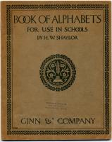
- "Book of Alphabets," 1908
- Contributed by: Maine Historical Society
- Date: 1908
- Media: Ink on paper
-
Buy
-
- Item 12197
-

- Division of the Tyng and Lowell estates, ca. 1760
- Contributed by: Maine Historical Society
- Date: circa 1760
- Media: Ink on paper
-
Buy
-
- Item 12408
-

- John Patten lot, Topsham, ca. 1760
- Contributed by: Maine Historical Society
- Date: circa 1760
- Media: Ink on paper
-
Buy
-
- Item 110900
-

- Map detail for portions of Cornwall and Bug Islands, ca. 1820
- Contributed by: Maine Historical Society
- Date: circa 1820
- Media: Graphite on paper
-
Buy
-
- Item 12560
-

- Plan of lots on Sheepscot Pond, Palermo, 1806
- Contributed by: Maine Historical Society
- Date: 1806-06-27
- Media: Ink on paper
-
Buy
-
- Item 5314
-

- Plan of rivers of Saco and Kennebunk, 1731
- Contributed by: Maine Historical Society
- Date: 1731
- Media: Ink on paper
-
Buy
-
- Item 11929
-

- Flying Point at Maquoit Bay, Freeport, ca. 1770
- Contributed by: Maine Historical Society
- Date: circa 1770
- Media: Ink on paper
-
Buy
-
- Item 110963
-

- Map of Lake St. Lawrence, 1820
- Contributed by: Maine Historical Society
- Date: 1814
- Media: Ink on paper
-
Buy
-
- Item 111008
-

- Pigeon River, including waterways between Lakes Kaseigunaha and Superior, ca. 1820
- Contributed by: Maine Historical Society
- Date: circa 1820
- Media: Ink on paper
-
Buy
-
- Item 116545
-

- Lake St. Lawrence, ca. 1820
- Contributed by: Maine Historical Society
- Date: circa 1820
- Media: Ink on paper
-
Buy
-
- Item 116552
-

- Lake Kaseiganagh east to Lake Superior, ca. 1825
- Contributed by: Maine Historical Society
- Date: 1817–1827
- Media: Ink on paper
-
Buy
-
- Item 5957
-

- William Patten's land, Topsham, 1771
- Contributed by: Maine Historical Society
- Date: 1771-04-12
- Media: Ink on paper
-
Buy
-
- Item 11739
-

- Map of Harpswell, 1771
- Contributed by: Maine Historical Society
- Date: 1771-06-17
- Media: Ink on paper
-
Buy
-
- Item 11741
-

- Map of Harpswell, 1742
- Contributed by: Maine Historical Society
- Date: 1742
- Media: Ink on paper
-
Buy
-
- Item 11748
-

- Joshua Scottow's land boundary, Brunswick, 1737
- Contributed by: Maine Historical Society
- Date: 1737-06-24
- Media: Ink on paper
-
Buy
-
- Item 11757
-

- John Robinson lot, Topsham, 1761
- Contributed by: Maine Historical Society
- Date: 1761
- Media: Ink on paper
-
Buy
-
- Item 11973
-

- Peletiah Haley's island, 1767
- Contributed by: Maine Historical Society
- Date: 1767-10-17
- Media: Ink on paper
-
Buy
-
- Item 11979
-

- Norridgewock Fort and Kennebec River, 1719
- Contributed by: Maine Historical Society
- Date: 1719
- Media: Ink on paper
-
Buy
-
- Item 108767
-

- Plan of land in Brunswick, ca. 1800
- Contributed by: Maine Historical Society
- Date: circa 1800
- Media: Ink on paper
-
Buy