Search Results 346 items were found.
Keywords: Colonial Map
-
- Item 10545
-
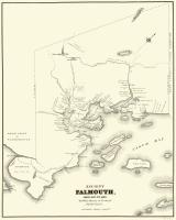
- Map of Ancient Falmouth from 1630 to 1690
- Contributed by: Maine Historical Society
- Date: circa 1630
- Media: Ink on paper
-
Buy


-
- Item 11722
-
- Map of Brunswick, lots on Merrymeeting Bay, ca. 1750
- Contributed by: Maine Historical Society
- Date: circa 1750
- Media: Ink on paper
-
Buy


-
- Item 149688
-
- Map of Maine, 1838
- Contributed by: Acadian Archives
- Date: 1838
- Media: Ink on paper
-
Buy


-
- Item 12937
-
- Map of lot no. 7, 135 acres on Madison Road, Skowhegan, ca. 1760
- Contributed by: Maine Historical Society
- Date: circa 1760
- Media: Ink on paper
-
Buy


-
- Item 116516
-
- Extract from a Map of the British and French Dominions in North America, 1755
- Contributed by: Maine Historical Society
- Date: circa 1755
- Media: Ink on paper
-
Buy


-
- Item 12940
-
- Map of lots G1 and G2 for James Pitts, near Clinton, 1769
- Contributed by: Maine Historical Society
- Date: 1769-11-07
- Media: Ink on paper
-
Buy


-
- Item 149687
-
- Map of Maine, ca. 1831
- Contributed by: Acadian Archives
- Date: circa 1831
- Media: Ink on paper
-
Buy


-
- Item 110997
-
- Map of the disputed portions of the New Brunswick and Lower Canada, 1839
- Contributed by: Maine Historical Society
- Date: 1839
- Media: Ink on paper
-
Buy


-
- Item 11924
-
- Lots on Maquoit Road, Brunswick, 1761
- Contributed by: Maine Historical Society
- Date: 1761
- Media: Ink on paper
-
Buy


-
- Item 11943
-
- Marquand Brunswick land, 1749
- Contributed by: Maine Historical Society
- Date: 1749-12-04
- Media: Ink on paper
-
Buy


-
- Item 4316
-
- Plan of J. Robinson lot, Topsham, 1761
- Contributed by: Maine Historical Society
- Date: 1761
- Media: Ink on paper
-
Buy


-
- Item 5335
-
- Brunswick and Topsham, ca. 1730
- Contributed by: Maine Historical Society
- Date: circa 1730
- Media: Ink on paper
-
Buy


-
- Item 4319
-
- Plan of Freeport, ca. 1795
- Contributed by: Maine Historical Society
- Date: circa 1795
- Media: Ink on paper
-
Buy


-
- Item 33847
-
- Champlain's map of Saco Bay and the Saco River, 1605
- Contributed by: McArthur Public Library
- Date: 1605
- Media: Photographic print
-
Buy


-
- Item 4325
-
- "Brunswick in the late Province of Mayne in New England," 1719
- Contributed by: Maine Historical Society
- Date: 1718-01-28
- Media: Ink on paper
-
Buy


-
- Item 11719
-
- "Maquoit," Brunswick, 1740
- Contributed by: Maine Historical Society
- Date: 1740-06-04
- Media: Ink on paper
-
Buy


-
- Item 4324
-
- Androscoggin and Kennebec Rivers, ca. 1755
- Contributed by: Maine Historical Society
- Date: circa 1755
- Media: Ink on paper
-
Buy


-
- Item 4318
-
- Androscoggin River above Lewiston, ca. 1750
- Contributed by: Maine Historical Society
- Date: circa 1750
- Media: Ink on paper
-
Buy


-
- Item 4323
-
- "Scituate," Brunswick, 1738
- Contributed by: Maine Historical Society
- Date: 1738
- Media: Ink on paper
-
Buy


-
- Item 12200
-
- Maps of lots on the Androscoggin River, ca. 1760
- Contributed by: Maine Historical Society
- Date: circa 1760
- Media: Ink on paper
-
Buy


-
- Item 20784
-
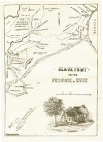
- Black Point, Scarborough, ca. 1633 - 1728
- Contributed by: Maine Historical Society
- Date: circa 1633
- Media: Ink on paper, map
-
Buy


-
- Item 102821
-
- A plan of the city and harbour of Louisburg, 1758
- Contributed by: Maine Historical Society
- Date: 1745
- Media: Ink on paper
-
Buy


-
- Item 12400
-
- Draper's claim northeast of Bath, 1795
- Contributed by: Maine Historical Society
- Date: 1795
- Media: Ink on paper
-
Buy


-
- Item 11928
-
- Fulton and Patten lots in Bowdoinham, 1759
- Contributed by: Maine Historical Society
- Date: 1759
- Media: Ink on paper
-
Buy


